

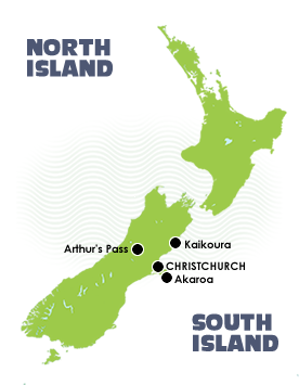
 The Canterbury Region
Christchurch, the islands largest city is located immediately north of Banks Peninsula with two large harbors of Lyttleton and Akaroa close by and having an international airport makes this city the perfect gateway into this exciting region.
Kaikoura
Further North is the seaside settlement of Kaikoura that sits on a rocky peninsula that juts out from the majestic Kaikoura mountain range, this open-coast environment is known for its whales, dolphins seals and penguins and offers a couple of great options to explore this area on foot.
The Kaikoura Coast Track
This three-day, 40-kilometer (27 Mile) track is self-guided or guided walk through beautiful private farmland and along the isolated and wild Kaikoura Coast (no crowded tracks here) with farm-cottage accommodation and pack transfers daily. The Track climbs from the sea to a height of 600 meters (1970 feet) and takes you along the untouched beauty of this Coast, with magnificent views of mountains, sea and remote farmland. Guided walks can be arranged, however the track is well sign posted.
The Kaikoura Wilderness Walkway
Take two or three day and traverse the 17 kilometers (10.5 Miles) of untamed wilderness of the Seaward Kaikoura Mountains. This exclusive guided hike has you staying your evenings in a luxurious wilderness lodge. With dramatic diversity over a relatively small area the track takes you through untouched Beech forests, stands of Kanuka and Manuka and ancient Totara forests.
Arthurs Pass
In Mid Canterbury, Arthur's Pass is the highest pass over the Southern Alps and straddles the mighty Southern Alps between Canterbury and the West Coast. Arthur's Pass National Park was established in 1929 as the South Islands first national park and although small in size, the park is known as a real alpine getaway full of very dense native bush, steep gorges, and snowy peaks. Probably the most popular walk is the day hike up the stunning Bealey Valley where you will encounter ancient beech forest and alpine wetlands. Further up the valley is a crystal clear mountain stream leading to the edge of the alpine zone and were rewarded with views up to Mt Rolleston and her permanent glaciers.
Banks Peninsula
Banks Peninsula is the most prominent volcanic feature in the South Island. Geologically, the peninsula is made up from the eroded remnants of two large volcanoes, Lyttelton formed first, then Akaroa. Originally it was an island but it became tied to the Canterbury Plains at some late stage of its geological history It has an area of approximately 1,150 square kilometres (714 square miles). Banks Peninsula has some stunning bays, beaches and coves. Many are very secluded - Tramping tracks around Banks Peninsula provide a challenging day or multi-day tramp. They are suitable for people with moderate to high level backcountry experience.
The Great Coastal Akaroa Walk
This is a 46-kilometer (28.5 miles), three-day, guided walk from Christchurch to Akaroa in the South Island of New Zealand. You travel along the Summit Ridge and across Banks Peninsula, in the Canterbury Region of the beautiful South Island of New Zealand.
The Banks Peninsula Track
Follow a stunningly diverse of 35-kilometer (25 Miles) track through forests and over vast fields as you explore the remote wild and outer bays of Banks Peninsula. The route includes this spectacular volcanic coastline, native bush, waterfalls and sandy beaches with two crossings of the crater rim high above Akaroa Harbour.